

Quick Navigation
- TART Trail: Traverse City's Paved Backbone
- VASA Pathway: Singletrack in the State Forest
- Sleeping Bear Heritage Trail: Pavement Through the Dunes
- White Pine Trail: Michigan's Longest Paved Trail
- North Central State Trail: Gaylord to the Straits
- When to Ride Up North
- Where to Stay Near the Trails
- Frequently Asked Questions
- Is Traverse City bike-friendly?
- How long is the TART Trail in Traverse City?
- What is the best mountain biking trail near Traverse City?
- What is the 92-mile paved bike trail in Michigan?
- How long is the Sleeping Bear Heritage Trail?
- When does the VASA Pathway close to mountain biking?
This post contains affiliate links to Booking.com. If you book through our site we may earn a commission — at no extra cost to you.
Traverse City mountain biking has a reputation that surprises people who only know the city for its cherries and wineries. The trails here are the real deal: 13 miles of dedicated singletrack at the edge of town, a 12-mile paved bayshore path, and a regional trail network that connects forest to lakefront to village without putting you near a car. Add a federal wilderness cycling trail an hour west and a crushed-limestone corridor running 75 miles north to the Straits, and you have a legitimate bike trip — not just a half-day diversion between tasting rooms. This guide maps out the routes worth riding and where to stay close to the action.
You can find more outdoor adventures in Northern Michigan across our full trail and activity coverage.
TART Trail: Traverse City's Paved Backbone
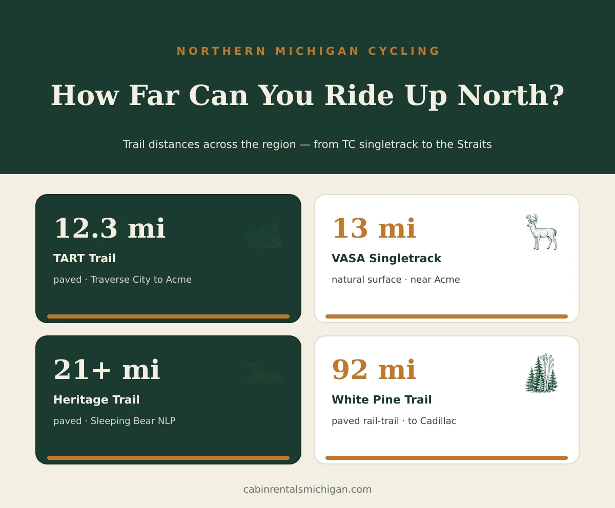
The Traverse Area Recreation and Transportation (TART) Trail is Traverse City's main paved corridor, running 12.3 miles east-west from the M-22 junction on the west side of town all the way to Acme Township on M-72. It's flat, well-maintained, and part of U.S. Bicycle Route 35 — which means it connects beyond the city limits into the broader regional trail network.
The most scenic stretch runs along the edge of West Grand Traverse Bay near Clinch Park Marina, where the trail traces the shoreline for several blocks. On a clear morning the water is a deep teal that makes the bay look like something from a tourism poster. The path is shared with commuters, families, and fitness riders of all speeds, and it gets busy on summer weekend mornings. Downtown rentals are available at several shops if you didn't bring a bike from your cabin.
VASA Pathway: Singletrack in the State Forest
About 10 miles east of downtown, the VASA Pathway cuts through the Pere Marquette State Forest near Acme with a loop system ranging from 3 km to 25 km. The trail network covers both a groomed cross-country ski corridor (wide, tracked, beginner-friendly terrain) and the VASA Singletrack — 13 miles of purpose-built mountain bike trail at the beginner-to-intermediate level.
The singletrack features berms, tabletops, rock gardens, and flowing descents through stands of birch and maple. Total elevation change is modest — roughly 100 feet — but the trail is punchy: short climbs followed by quick drops keep momentum high and the riding engaging. The VASA Pathway serves as the final kilometers of the Iceman Cometh Challenge each November — the largest one-day, point-to-point mountain bike race in North America.
The trailhead at 5450 Supply Road has parking and is well-signed. The inner loops (3 km, 5 km) are manageable in 30 to 45 minutes for most riders. A full 25 km lap takes 1.5 to 2.5 hours depending on pace.
Sleeping Bear Heritage Trail: Pavement Through the Dunes
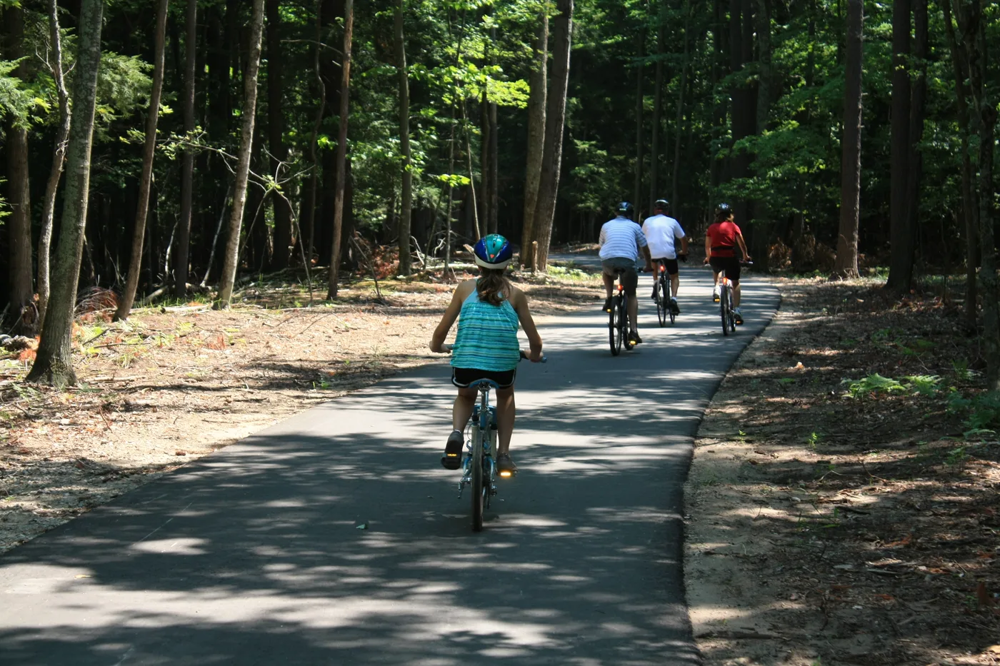
The Sleeping Bear Heritage Trail is more than 21 miles of paved, multi-use pathway winding through Sleeping Bear Dunes National Lakeshore between Empire and Glen Arbor. Unlike a city path, this one runs entirely within a protected federal landscape — so the tree-framed views of Glen Lake and Lake Michigan, and the occasional glimpse of blowing sand above the tree line, are part of every ride.
The trail is almost entirely car-free and well-shaded through the forested sections. There are gentle rolling grades, but nothing steep. Glen Arbor makes a natural midpoint for a rest stop, with waterfront parks, coffee, and food along the village street. Allow 2.5 to 3.5 hours for the full out-and-back from Empire. Bike rentals are available in Glen Arbor.
This trail pairs naturally with a day of hiking Sleeping Bear Dunes — ride in the morning, hike the dunes in the afternoon, and you've earned dinner without question.
White Pine Trail: Michigan's Longest Paved Trail
The White Pine Trail State Park stretches 92 miles of paved rail-to-trail corridor from Comstock Park, near Grand Rapids, north to Cadillac. The trail follows a former railroad route, which means it's nearly flat for its entire length — no grades, no switchbacks, just long stretches of former right-of-way passing through farmland, river crossings, and second-growth pine forest.
The northern section from Reed City through Cadillac is the most scenic, crossing the Muskegon River and threading past quiet crossroads towns with cafes and general stores. A cabin stay near Cadillac turns this into a genuine cycling weekend: ride south one morning, stop for lunch in Reed City at the 15-mile mark, turn around, and you've covered 30 miles round-trip with barely a hill.
North Central State Trail: Gaylord to the Straits
The North Central State Trail covers 75 miles of crushed-limestone pathway from Gaylord north to Mackinaw City, tracing the old Michigan Central Railroad corridor through pine barrens, spruce bogs, and quiet northern towns. The firm limestone surface handles hybrids and gravel bikes well; narrow road tires are less comfortable but manageable on dry days.
The trail is one of the most remote long-distance routes in the Lower Peninsula — long, quiet sections through deep pine forest with very few road crossings. Riders who pair this with a Gaylord cabin stay can head north at dawn, reach Vanderbilt or Wolverine for a midpoint rest, and still be back before afternoon. The northern stretches approaching Cheboygan and Mackinaw City pass through old-growth pine stands that feel genuinely wild.
When to Ride Up North
| Season | Conditions | Best Routes |
|---|---|---|
| May–June | Cool temps, trails firm after spring thaw; bugs minimal by mid-May | VASA singletrack, Heritage Trail, White Pine Trail |
| July–August | Warm and dry; singletrack fast and consistent; all trails busy | All routes; TART Trail and Heritage Trail at peak activity |
| September–October | Fall color peaks mid-Sept to mid-Oct; cooler temps, almost no bugs | North Central State Trail, VASA Pathway, White Pine Trail |
| November–April | VASA closes to bikes once ski season opens (typically December); paved routes can be icy Nov–March | TART Trail and Heritage Trail on dry winter days; VASA in November if snow holds off |
Watch the TART Trail in action:
Where to Stay Near the Trails
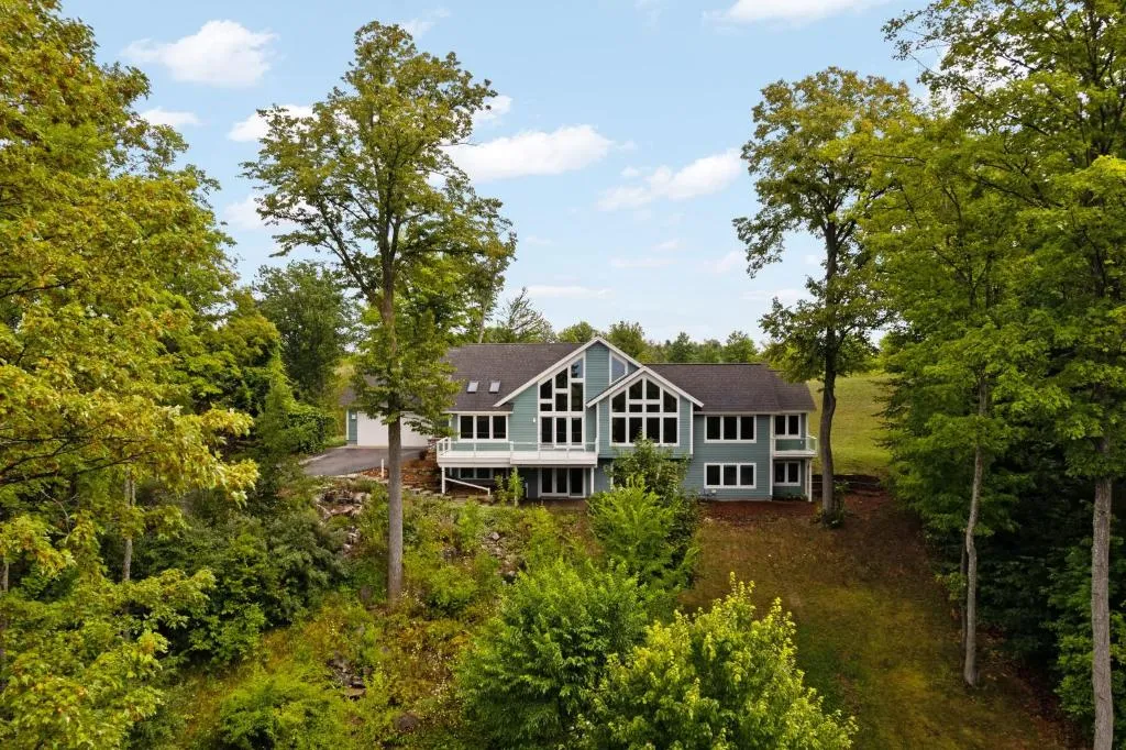
The VASA trailhead is in Acme Township, about 10 miles east of downtown Traverse City — which puts most TC-area cabins near the VASA trail within a 15 to 20-minute drive of the singletrack. The TART Trail connects directly from the marina district, so waterfront properties on the bay are the most convenient base for paved riding. For the Sleeping Bear Heritage Trail, Glen Arbor lodges and cottages put you at the trailhead.
Seven Hills Estate
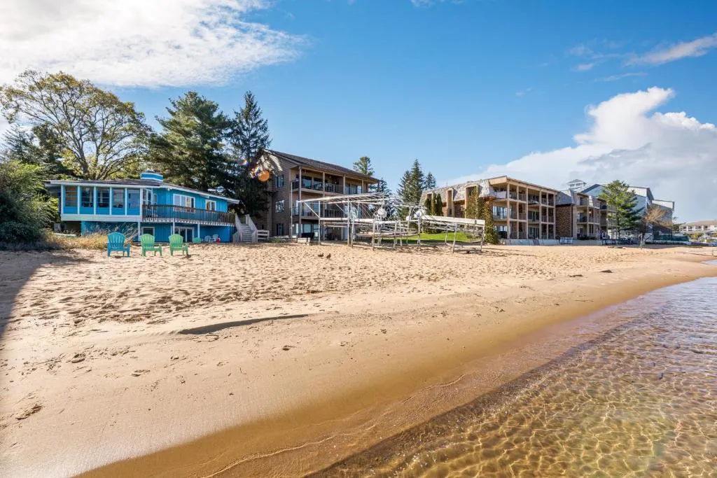
East Bay Escape
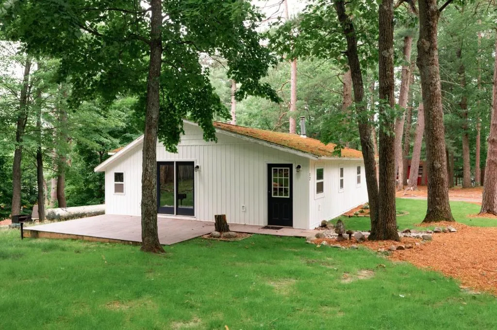
Arbutus Lake Retreat
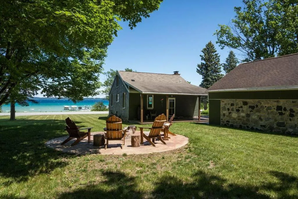
Baydream Believer
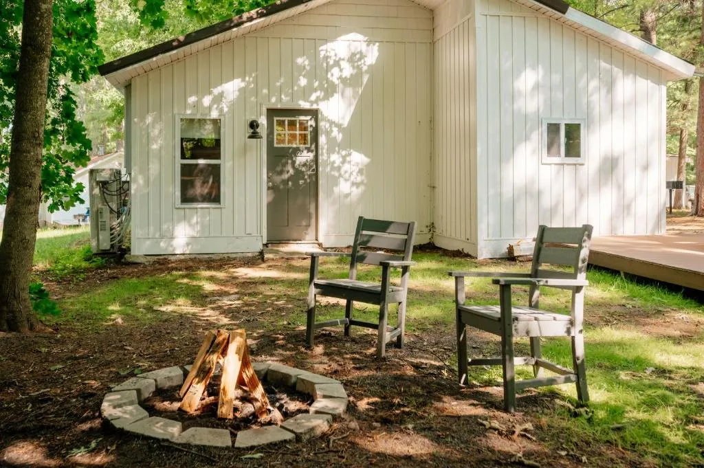
Arbutus Lake Cabin
Firefly Lodge
Ready to ride?
Browse cabins near the VASA trailFrequently Asked Questions
Is Traverse City bike-friendly?
Yes. Traverse City has an expanding paved trail network anchored by the 12.3-mile TART Trail, strong cycling infrastructure downtown, and bike-friendly roads throughout the region. The VASA Singletrack east of town adds 13 miles of dedicated mountain bike terrain. Rental shops downtown make it easy to arrive without your own bike.
How long is the TART Trail in Traverse City?
The TART Trail runs 12.3 miles east-west across Traverse City, from the M-22 junction on the west side to Acme Township on the east. The trail is paved, flat, and part of U.S. Bicycle Route 35, with additional connector trails extending the network into Leelanau and Grand Traverse counties.
What is the best mountain biking trail near Traverse City?
The VASA Singletrack near Acme is the most popular choice — 13 miles of purpose-built beginner-to-intermediate mountain bike trail through the Pere Marquette State Forest. The Iceman Cometh Challenge, one of the largest off-road races in North America, uses this trail system each November.
What is the 92-mile paved bike trail in Michigan?
The White Pine Trail State Park, a paved rail-to-trail corridor running 92 miles from Comstock Park near Grand Rapids north to Cadillac. It's Michigan's longest paved trail, nearly flat the entire length, and passes through a dozen small towns along the route.
How long is the Sleeping Bear Heritage Trail?
More than 21 miles of the planned 27-mile trail are currently open, running through Sleeping Bear Dunes National Lakeshore between Empire and Glen Arbor. The trail is paved and multi-use, connecting park amenities, beaches, and villages along the way.
When does the VASA Pathway close to mountain biking?
The groomed VASA Pathway closes to cyclists once cross-country ski conditions arrive, typically in December. The VASA Singletrack may remain open longer depending on snow cover. Check the Michigan DNR and TART Trails websites for current trail status before a late-fall ride.
- Michigan DNR — VASA Pathway trail page
- TART Trails Inc. — VASA Pathway trail guide
- Michigan DNR — Fred Meijer White Pine Trail State Park
- Michigan DNR — North Central State Trail
- TART Trails Inc. — Sleeping Bear Heritage Trail